Wells Fargo Lake Minnetonka Half Marathon
May 7, 2006 and future years
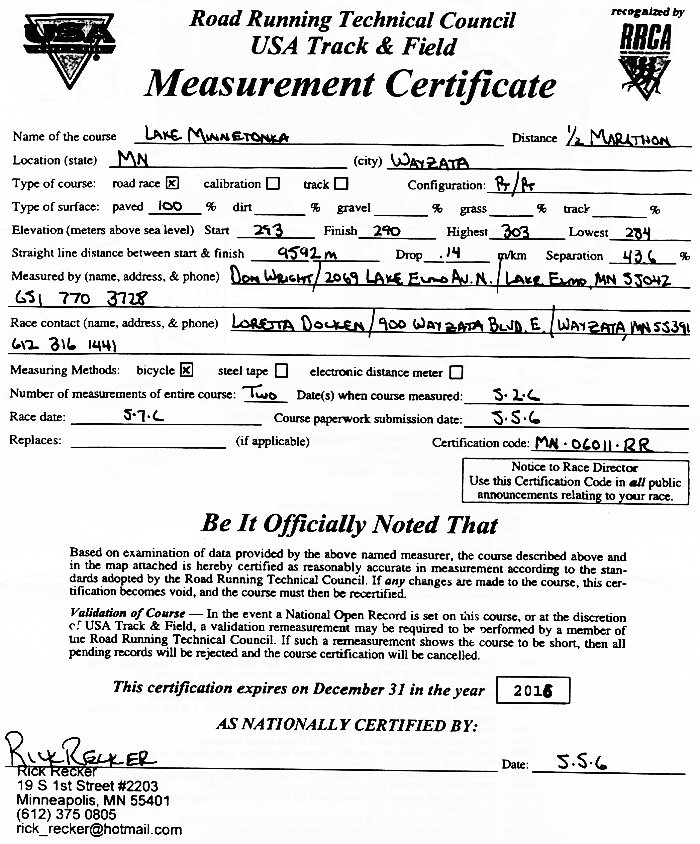
MN 06011 RR
Course:
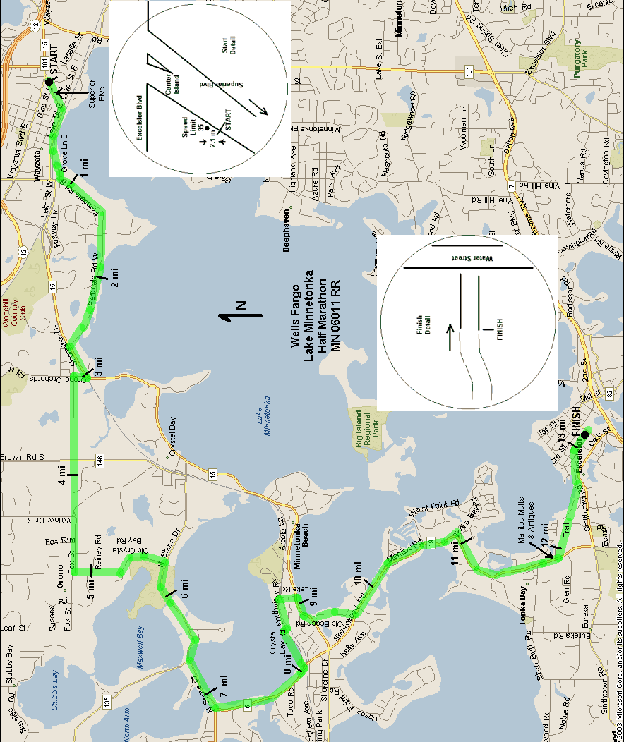
• Start in Wayzata on Superior Blvd near Wayzata Blvd, heading SW.
• Right (W) on Lake St.
• Left (SW) on Grove Ln E, curve W through parking lot & park.
• Left (S) on Ferndale Rd, curve to W.
• Left (SW) on Shoreline Dr (cone off the shoulder).
• Sharp right (N) briefly on Orono Orchard Rd.
• Left (W) on Fox St.
• Left (S) on Old Crystal Bay Rd.
• Right (W) on North Shore Dr (cone off the left shoulder).
• Left (S) on Shadywood Rd (cone off the left shoulder).
• Left (E) on Crystal Bay Rd, which becomes Northview Rd.
• Right (S) on Lake Rd.
• Right (SW) on Shoreline Dr (cone off left shoulder).
• Left (S) on Old Beach Rd. At the end, continue on the short paved trail.
• Left (SE) on Shadywood Rd, which becomes Manitou Rd (cone off left shoulder).
• Just past Brentwood Ave, left (E) on packed-gravel recreational trail.
• Finish between the wooden fences just W of Water St in Excelsior.
Measured Points:
“Left” and “right” are with reference to the direction that the runners travel. Marks are in red paint.
Start: Going SW on Superior Blvd, 2.1 m (6' 11") SW of sign “Speed Limit 35" on right shoulder. This is about 35 m (115 ft) SW of center island in Superior where it meets Wayzata Blvd.
1 Mile: Ferndale Rd right side 14 m (46 ft) NE of mailbox 320.
2 Mile: Ferndale Rd left side 22 m (72 ft) E of power pole J55058(F05) at 622 Ferndale.
3 Mile: Shoreline Dr right side just before turning onto Orono Orchard Rd, 4 m (13 ft) NE of sign on adjacent abandoned RR track “No unauthorized motor vehicles.”
4 Mile: Fox St left side 15 m (49 ft) E of mailbox 2120.
5 Mile: Old Crystal Bay Rd left side 6.5 m (21 ft) N of stop sign of Rainey Rd.
6 Mile: North Shore Drive left side, just NE of Maxwell Bay bridge, 13 m (43 ft) NE of sign on left side “No Parking Vehicles With Trailers” on left side of road.
7 Mile: North Shore Drive left side, 25 m (82 ft) NE of mailbox 3645 along North Arm bridge rail.
8 Mile: Shadywood Rd left side, NW edge of SE driveway (of two) for 2190.
9 Mile: Shoreline Dr left side just after leaving Lake Rd, 21 m (68 ft) SW of sign on left side “No Passing on Shoulder.”
10 Mile: Shadywood Rd left side, 12 m (39 ft) SE of mailboxes for 2780 and 2800.
11 Mile: Manitou Rd left side, 10 m (33 ft) NE of mailboxes for 4766-4774.
12 Mile: Packed gravel trail just off Manitou Rd, adjacent E edge of garage door W of door S1 New Engineering.
13 Mile: Packed gravel trail, 7 m (23 ft) W of sign in ditch on S side “Hennepin County Regional Railroad Authority.” This is also 75 m (247 ft) W of where the trail becomes asphalt.
Finish: W post of the S wooden fence. Not marked.
Measured May 2, 2006
Don Wright
651 770 3728